
- Home /
- Things-to-do /
- Attractions /
- Countryside /
- Mam Tor
Mam Tor
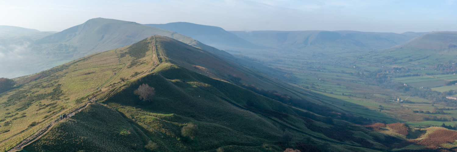
Mam Tor is one of the highlights of the Peak District in an area that’s full of gems. The name means Mother Hill because the frequent landslips have created a series of mini-hills around it. This geological instability caused by layers of shale also gives Mam Tor its other name, Shivering Mountain.
It’s not a mountain though. In fact, it’s a relatively easy climb even with young children. From the trig point at the top though, you can see for miles. The 360º panorama is particularly impressive because Mam Tor is located where the Dark Peak and the White Peak meet so the landscape is more varied. On a clear day, you can even see Manchester in the distance.
There’s a lovely circular walk which takes in the steps up to Mam Tor and its trig point then follows the ridge path to Hollins Cross before descending and walking along Broken Road. Initially, it just looks like the council haven’t been round to fill in the potholes for a while and then you see the power of the landslips in this area. The twisted tarmac shapes of what was once the A625 are like something from a dystopian film about the apocalypse.
The route continues past Blue John Cavern which is also an excellent place to visit. Parking is tricky because it gets so busy. The best places are probably along Old Mam Tor Road near the entrance to Blue John Cavern or the National Trust car park on Rushup Edge. You’ll need the Ordance Survey OL1 Explorer Map or, if you’re using the app, download it before you set off. Do not expect superfast broadband at the top of Mam Tor.

- Open: Mon, Tue, Wed, Thu, Fri, Sat, Sun
- Adventure Families Outdoor exercise Great views Hiking


You might also like…


